Graz Maps and Orientation
(Graz, Styria, Austria)
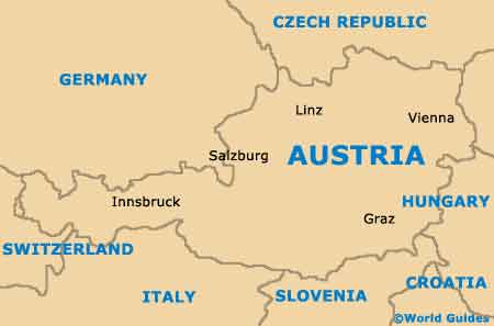
Actually the second-biggest of Austria's many cities, Graz is located on the south-easterly side of the country and close to the borders of Croatia,
Hungary and also Slovenia. The population of Graz is now well over 250,000 people and rapidly approaching 300,000.
Graz resides within the state of Styria, where it is the state capital and has grown up around the River Mur. Visitors will soon notice how the city is dominated by its rather prominent Castle Hill, known locally as the Schlossberg and stands high above the city centre itself.
Maps and Orientation of the City
The western side of the Schlossberg is edged by the River Mur, which runs in a north to south direction through central Graz and actually separates the railway station (Hauptbahnhof). Trams link the station with the centrally located Hauptplatz, and a number of notable streets radiate outwards from this prominent public plaza, such as both the Sporgasse and also the Herrengasse, an important pedestrianised artery.
Maps of Graz are best obtained at the tourist information outlet on Herrengasse (Graz Tourismus), while maps are also available at the information counter within the railway station.
- Bruck an der Mur - 55 km / 34 miles (50 minutes, north)
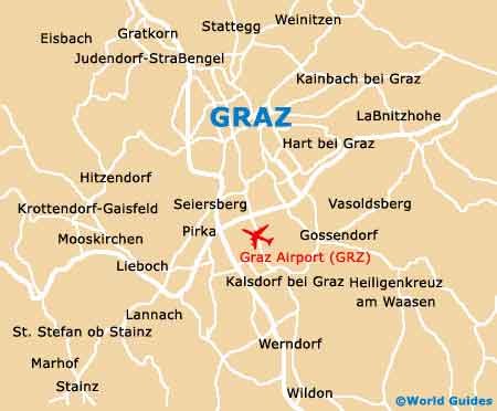
- Feldkirchen bei Graz - 8 km / 5 miles (15 minutes, south)
- Forst Kalsdorf bei Graz - 15 km / 9 miles (20 minutes, south)
- Frohnleiten - 30 km / 19 miles (35 minutes, north)
- Gössendorf - 12 km / 7 miles (18 minutes, south)
- Hart bei Graz - 8 km / 5 miles (15 minutes, east)
- Hartberg - 75 km / 47 miles (one hour and 15 minutes, north-east)
- Kainbach bei Graz - 11 km / 7 miles (16 minutes, east)
- Kapfenberg - 60 km / 37 miles (one hour, north)
- Leoben - 66 km / 41 miles (one hour and five minutes, north-west)
- Linz - 220 km / 137 miles (two hours and 30 minutes, north-west)
- Maribor (Slovenia) - 50 km / 31 miles (45 minutes, north-west)
- Rannach - 12 km / 7 miles (18 minutes, north)
- Rohrbach - 20 km / 12 miles (25 minutes, west)
- Salzburg - 280 km / 174 miles (three hours and 20 minutes, north-west)
- Stattegg - 9 km / 6 miles (15 minutes, north)
- Thal - 12 km / 7 miles (18 minutes, west)
- Wolfsberg - 83 km / 52 miles (one hour and 20 minutes, south-west)
- Vienna - 199 km / 124 miles (two hours and 15, north-east)
Map of Austria
Map of Graz